As wildfires grow more common and severe, tech startups say they can help
Reining in wildfires will take much more than tech solutions, but some startups think there’s a role for AI, ML, drones, and more.
Pano
· 6 min read
Thanks to climate change, wildfires are getting worse. And as the fires grow more severe and more common, firefighters are stretched thin.
Policy-makers, activists, and experts are pushing for a number of both long-term and immediate changes to try and alleviate this situation, from decarbonizing the economy to improving forest management in at-risk areas. In recent years, tech startups have entered the fray as well, claiming that emerging tech like AI, machine learning, drones, and sensors can help firefighters do more with less, or with the same.
These startups—like Pano, which offers hardware and software solutions solely for firefighters, or Edgybees, a geospatial intelligence firm whose tool can help with wildfire response—have raised tens of millions of dollars to date. Many are still in the early stages, running pilots with various fire departments in the American West in an attempt to both gain footholds and refine their models for the wider community.
“We learned that actually there were calls from many areas, like the Gavin Newsom administration, from the firefighting community, from the utility industry, from universities, from nonprofits—there were numerous reports and events where thought leaders were calling for more technology to help better detect and respond to fires,” Sonia Kastner founder and CEO of Pano told Emerging Tech Brew. “They were calling for cameras and drones and satellites and AI.”
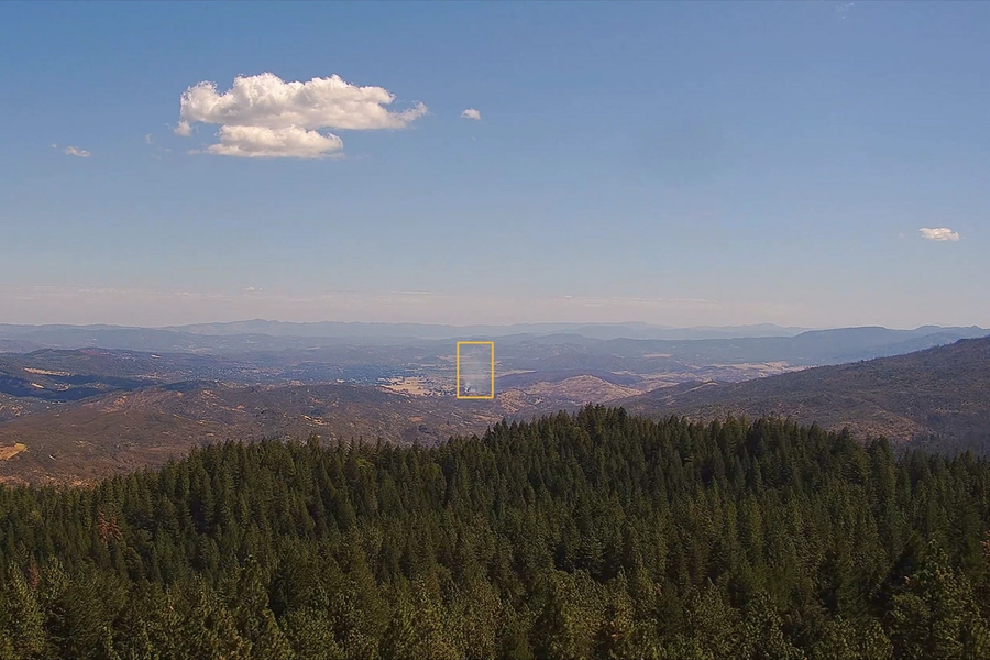
For its part, Pano says it has raised $6.5 million since its 2020 founding. The 20-person company positions networks of cameras throughout high-risk fire areas, which aim to identify and track wildfires at their source.
Pano wants to put its cameras in high vantage points, whether it be mountains, radio towers, or—even better—radio towers on top of mountains. This would provide a wide overview of at-risk forests. Its cameras can then monitor these areas 24/7, feeding video to an AI system trained to flag smoke plumes and conflagrations on a minute-by-minute basis. Human reviewers are in the loop, too, confirming what the AI flags and ultimately making the call to notify fire departments.
The company’s ultimate goal is to deploy 5,000+ cameras, and to detect wildfires before they spiral out of control. But it’s early days: Pano says it has deployed cameras in 22 locations throughout Oregon, California, Colorado, and Montana. And in Redwood City, one of the locations where its tech is deployed, Pano has mainly detected structure fires the department was already aware of.
“Cameras can be used not just for detection with AI, but they can also be used for that essential confirmation step,” Kastner said. “We have a Pano intelligence center that reviews all of these feeds. They review our AI detections, they review the satellite alerts, they review the 911 feeds, and then they go and cross-reference that with the camera feeds to pinpoint smoke.”
Pano, which has conducted pilots with fire agencies like South Lake County Fire Protection District and the Big Sky, Montana, fire department, hopes its tech can simplify a confirmation process that in its current state is cumbersome and time-consuming—and, as a result, dangerous.
Traditionally, detecting fires has included using lookout towers or calls from bystanders. When phone calls come in reporting a wildfire, fire agencies would travel to a high point in the area to visually confirm and pinpoint the smoke plume. This process is full of issues, in particular the time-consuming nature of climbing a hill to spot a fire. In that time, what was initially a small fire can turn into a large one, all before fire authorities even know how to respond.
Keep up with the innovative tech transforming business
Tech Brew keeps business leaders up-to-date on the latest innovations, automation advances, policy shifts, and more, so they can make informed decisions about tech.
“The fire agencies, we would go to one of the highest spots that we could...and we drive there and we try to figure out where the fire was,” Denise Enea, former fire marshal of Woodside Fire Protection District in California, told Emerging Tech Brew. “Then we communicate with other crews trying to go to the fire and try to pinpoint it that way. You can imagine how Neanderthal and how clumsy that was, you know?”
Other companies, like wildfire-focused disaster management platform Cornea, and geospatial intelligence firm Edgybees, are leveraging technology like drones and satellites to give firefighters a detailed overview of developing fires.
Edgybees, which has raised $16.4 million since 2017 and works with four fire departments in California, Florida, and Australia, focuses on visually augmenting aerial and satellite imagery. It overlays raw feeds with information like street layouts, traffic lights, and other key landmarks, which CEO Adam Kaplan told us is “like Google Maps and Google Earth on steroids.” (For what it’s worth, Google Maps now has wildfire maps as well.)
These overlays, mixed with real-time footage from drones, could allow firefighters to better understand the situation on the ground, enabling a faster and more accurate response to fires—especially ones that creep into residential areas.
Cornea was founded in 2018, and its chief fire officer is Tom Harbour, who headed up fire response for the US Department of Forest Services for over a decade. Cornea CEO Margot Preuss told us the company is working with at least two "state level fire departments out west," as well as the US Forest Service’s Rocky Mountain Research Station and Colorado State University to refine the machine-learning algorithms it uses to try and predict the size and scope of a wildfire as it grows.
One of Cornea’s two products involves aggregating information from places like satellite imagery and historical fire data, and using that to then assign a suppression difficulty rating to a fire. Firefighters can then use the rating to make decisions on where to allocate resources and personnel. Cornea’s algorithm can produce these ratings in a matter of minutes, the company claims, potentially saving time in a process where every second matters.
“This machine learning tool [is] hopefully going to reduce the hours someone spends fighting a fire, and then in the off season, help them control future fires with planning,” Preuss said.
Effective technology could make all the difference when it comes to fighting fires, but throwing an abundance of tech to firefighters isn’t a solution in and of itself; the tech needs to be easy to use. Each company told us it works directly with fire authorities, training them in their tech so that response times are rapid and fires can be kept under the 10-acre size authorities like Cal Fire, the California Department of Forestry and Fire Protection, say are essential to keeping fires under control.
“The goal is to make the output as simple as possible,” Preuss said. “They don’t need to know what’s happening in the background of the machine-learning algorithms, but they need to know, as a first responder, where is this fire heading, what’s the scale, and how do I most efficiently put it out?”
Keep up with the innovative tech transforming business
Tech Brew keeps business leaders up-to-date on the latest innovations, automation advances, policy shifts, and more, so they can make informed decisions about tech.